 View More
|
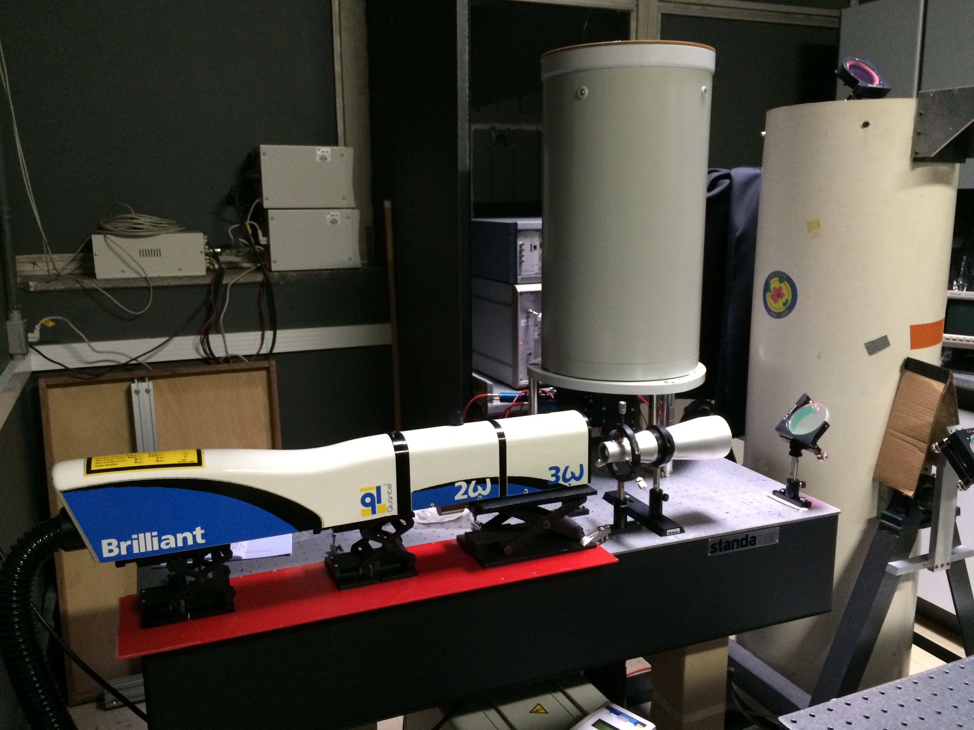
Raman and elastic lidar system MSP-Lidar IThe MSP-Lidar I (LIDAR do Município de São Paulo) is a multiwavelength Raman LIDAR operated by the Lasers Environmental Applications Research Group at the Center for Lasers and Applications (CLA), Nuclear and Energy Research Institute (IPEN) in São Paulo (−23◦ 56’ S, 46◦74’ W, 740 m above sea level). It is a monoestatic coaxial system, pointed vertically to the zenith and using a commercialized Nd:YAG (neodymium-doped yttrium aluminium garnet; Nd:Y3Al5O12) laser by Quantel, model Brilliant B, with a fundamental wavelength of 1064 nm, and generating second and third harmonics, 532 nm and 355 nm, respectively, at a repetition rate of 10 Hz. The output energy per pulse is 850 mJ for 1064 nm, 400 mJ for 532 nm and 230 mJ for 355 nm. The pulse duration is 6 ± 2 ns. The laser beam has an average diameter of 9 mm and is directed to a beam expander (expands the three wavelengths), which increases the beam diameter about 5 times, with a divergence of less than 0.1 mrad. The expanded laser beam is directed to the atmosphere through a second set of mirrors. A 30 cm diameter telescope (Focal length of 1.5 m) is used to collect the backscattered laser light. The telescope’s field of view (FOV) can be adjusted and once a desirable value of 0.1 mrad is reached, using a small diaphragm. The system is currently used with a fixed FOV of 0.1 mrad, which permits a full overlap between the telescope FOV and the laser beam at altitudes higher than 500 m above the ground level. This FOV value, in accordance with the detection electronics, permits the probing of the atmosphere up to the free troposphere. The detection box collects six different wavelengths and separates them into 6 different channels (the elastic 355 nm and the corresponding shifted Raman signals: nitrogen 387 nm, and water vapor, 408 nm; the elastic 532 nm and the corresponding shifted Raman signals: nitrogen 607 nm and water vapor 660 nm) using a combination of high-pass and low-pass filters. Each splitted bean is directed to narrowbands spectral interference filters (532±1nm FWMH, 355±1 nm FWMH, 387±0.25nm FWMH, 408±0.25 nm FWMH 607±0.25 nm FWMH, 660±0.25 nm FWMH) and then directed to photomultipliers tubes (PMTs). R7400 photomultiplier tubes from Hamamatsu are used for all channels, except for 607 and 660 nm, where R9880U-20 are used. The PMT signals are digitized by a transient recorder TR 20-80/160 for 532 nm, TR 20-160 for 355, 387 and 408 nm, TR 20-40 for 607 and 660 nm, all supplied by LICEL. They are recorded in both analog and photoncounting mode. Corrections of background noise and the dark current are applied before analysis. The current vertical spatial resolution is 15 meters. |
|---|
 View More
|
Calibration systemThe Lidar Calibration system consist of a 45-watt quartz-halogen tungsten coiled filament calibrated lamp, supplied by Gooch & Housego. The calibrated lamp has a spectral irradiance of about 3x10⁻⁷ W/cm nm. This calibrated lamp was adapted to a programmable translation system, supplied by Arrick Robotics, which went through a perimeter that covered the entire area of the telescope in adjustable steps by a stepper motor. The calibration methodology has been used to verify the performance of a 6-channel lidar system based on a scanning calibrated lamp. The whole calibration analysis can be made in 3 steps when a first scan is made and some mis-performances related to stray light can be detected. Then, after correcting the first issue a second run is perform, allowing us to identify a misalignment in one of the channels and again after correcting we can be made the last run and optimize the filter selection for each channel in a way to get the best signal-to-noise ratio (SNR) possible. |
|---|
 View More
|
Raman and elastic lidar system MSP-Lidar IIA biaxial mode single wavelength elastic and Raman Lidar system (MSP-Lidar II) installed at the Nuclear and Energy Research Institute (IPEN) was employed to measure independently profiles of the particle extinction and backscatter coefficients and, thus, the respective particle extinction-to-backscatter ratio at 532 nm. A frequency-doubled Nd:YAG laser (CFR200) is used as the light source. It emits pulses energy of 120 mJ nominal at the 532 nm, with a repetition rate of 20 Hz and pulse duration of 9.2 ns. The light beam is expanded by a factor of 3, in order to reduce the divergence of the expanded beam less than 0.2 mrad. The laser beam is vertically directed to the atmosphere and the backscattered radiation is collected with a Cassegrain telescope that has a primary mirror diameter of 200 mm and a focal length of 800 mm. The receiver field of view is set to 1.25 mrad, and thus the complete overlap of laser beam and the telescope field of view is observed at altitudes higher than 300 m above the Lidar system, which limits the minimum range of our measurements. After separating and passing the respective interference filters, the photons elastically backscattered at the 532 nm wavelength and the photons inelastically (Raman) scattered by nitrogen molecules at 607 nm are detected with photomultiplier tubes (PMTs, Hamamatsu type R9880U-110). The bandwidth of the filters in 532 and 607 nm channels are 0.5 and 1 nm, respectively. LICEL receiving electronics has provision to operate both in analog and photon counting mode and to record data in 12-bit resolution. Data are averaged every 2 min, with a typical height resolution of 7.5 m. Since Raman signal is too weak to be detected under bright daytime conditions, measurements are proceed only during night-time, when the return signal no longer suffers from the solar background interference.16, 17 In addition, the Raman signal is amplified and acquired by a photon counting mode. Since 2008 the MSP-Lidar II system is part of LALINET (http://lalinet.org), that is a coordinated lidar network focused on the vertically-resolved monitoring of the particle optical properties distribution over Latin America. |
|---|
 View More
|
Duster Lidar systemThe Duster Lidar system is a four-channel ground-based lidar for aerosol profiling, including polarization, operated by the Lasers Environmental Applications Research Group and will be installed in the North-eastern part of South America in the near future. As a new LALINET station, the Duster Lidar will be deployed at Natal (Rio Grande do Norte, Brazil, 5.84º S, 35.20º W) with the aim of characterizing the transcontinental transport of aerosol particles from Africa to South America, mainly Saharan dust and biomass burning, before their potential contamination with local particles. It will be a monoestatic biaxial system, pointed vertically to the zenith and using a commercialized Nd:YAG (neodymium-doped yttrium aluminium garnet; Nd:Y3Al5O12) laser by Quantel, model Brilliant B, with a fundamental wavelength of 1064 nm, and generating second and third harmonics, 532 nm and 355 nm, respectively, at a repetition rate of 20 Hz. The output energy per pulse is 400 mJ for 1064 nm, 200 mJ for 532 nm and 100 mJ for 355 nm. The pulse duration is 6 ± 2 ns. The laser beam has an average diameter of 9 mm and is directed to a beam expander (expands the three wavelengths), which increases the beam diameter about 5 times, with a divergence of less than 0.1 mrad. The expanded laser beam is directed to the atmosphere through a second set of mirrors. A 40 cm diameter telescope (Focal length of 2.0 m) is used to collect the backscattered laser light. The detection box collects three different wavelengths and separates them into 4 different channels, the elastic 1064 and 355 nm and the parallel and perpendicular polarization signal at 532 nm using a combination of high-pass and low-pass filters. The complete configuration of Duster Lidar will be available as soon as the instrument is installed. |
|---|
 View More
|
Elastic lidar system MSP-Lidar IIIThe scanning lidar system (MSP-Lidar III) is a multiwavelength elastic system with scanning capability and biaxial configuration. The light source is a commercial Nd:YAG laser (CFR 450, Quantel SA) operating at 355, 532 and 1064 nm with a fixed repetition rate of 20 Hz and energies per pulse between 100 and 400 mJ. The receiving module is a 150 mm diameter Dall-Kirkham telescope and focal length of 1000 mm which collects the backscattered laser light. It is currently used with a fixed field-of view (FOV) of 1 mrad, which permits a full overlap between the telescope FOV and the laser beam at heights around 120 m above the system. This FOV value, together with the detection electronics, enables sampling at distances up to 7 km. The backscattered laser radiation is detected by two photomultiplier tubes (Hamamatsu) and one Si- avalanche photodiode (EG&G) coupled to narrowband interference filters to assure the reduction of the solar background during daytime operation and to improve the signal-to-noise ratio. The detected signals are recorded by a transient recorder in both analog (AN) and photocounting (PC) mode with selectable spatial resolutions of 3.75, 7.5, 15 and 30 m. The laser and telescope devices are attached to a scanning base adapted from a 2 AP sun tracker that performs changes in both azimuthal and polar angles with an accuracy of less than 0.02º. This system has two stepper motors controlled by an on-board micro-computer to program a full scanning over a desired angle range. The scanning lidar system (MSP-Lidar III) is located at CEPEMA (Centre for Training and Research in Environment) in Cubatão, installed approximately 400 m far from a Petrobras oil refinery flare stack and it has a total height of approximately 40 m relative to the ground level. |
|---|
 View More
|
Cavity Ring-Down Spectroscopy CRDSA high sensitive Cavity Ring-Down Spectroscopy (CRDS) system is proposed to monitoring the aerosol extinction coefficient in the city of São Paulo, Brazil. A continuous range of wavelengths in the visible region is used to excite the cavity. This continuous range is provided from a fiber-based super continuum light source illuminating one end of the cavity at a repetition rate of few kHz. The signal through the cavity is selected by a spectrometer and then recorded by an iCCD camera. The reference measurement is performed under vacuum while the measurement for absorption/extinction is performed by sampling ambient air (preferably from an atmosphere containing aerosol particles) directly into the cavity. |
|---|
 View More
|
SodarThe Sodar operates by emitting a short pulse and listening to the atmospheric echo from that pulse. The echo is a result of the continuous interaction between the outward propagating acoustic energy and atmospheric turbulence. The echo, when received by the Sodar microphone array, is processed for its frequency content. A change in frequency is associated with movement of the atmospheric turbulence by the local wind field. Using the Doppler shift principles, the echo frequency will be greater than the pulse frequency if this movement is toward the microphone array. A lower frequency with respect to the pulse frequency implies that the movement is away from the microphone array. The outgoing pulse is not affected in frequency until it is echoed by the interaction with atmospheric turbulence and retuned to the microphones. The time this process takes is proportional to the distance (height). Using information from three different directions (and decoding the data in terms of its first order geometry (i.e., neglecting refraction effects), the altitude gated frequencies enable a full wind profile to be measured. A radio acoustic sounding system (RASS) is a system for measuring the atmospheric lapse rate, using backscattering of radio waves from an acoustic wave front to measure the speed of sound at various heights above the ground. This is possible because the compression and rarefaction of air by an acoustic wave changes the dielectric properties, producing partial reflection of the transmitted radar signal. From the speed of sound, the temperature of the air in the planetary boundary layer can be computed. The maximum altitude range of RASS systems is typically 750 meters, although observations have been reported up to 1.2 km in moist air. A Sodar with RASS is deployed for monitoring the vertical distribution of wind (u, v, w) and temperature within the lower Planetary Boundary Layer (PBL). The nominal height of the Sodar is up to 2000 m and of the RASS ca 1000 m AGL, depending on settings and meteorological conditions. Unfortunately, due to limitations of the current location, not being ideal, the Sodar only reaches up to about 500 m AGL. |
|---|